

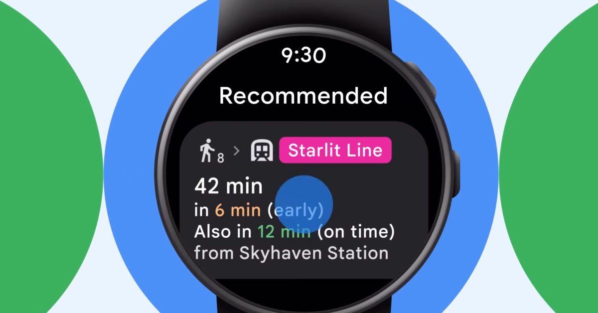
Google today announced a handful of wearable and navigation updates, starting with public transit directions in Google Maps for Wear OS.
Google today announced a handful of wearable and navigation updates, starting with public transit directions in Google Maps for Wear OS.
Offi works quite well
I’ve never heard of it, but I can’t get it to work to check it out. Looks like it doesn’t support my country (well enough). It doesn’t seem to advertise turn by turn navigation for public transit, though, so I wonder how it compares.
It also doesn’t seem to have an Android Watch app, but perhaps smart watch functionality is part of the Android base app?
Crap, I forgot we were on a thread about smart watches. I wouldn’t know how it works on one, since I don’t own any.
But turk by turn works as good as it can for any public transport service. It tells me when and where I need to change. How long the change is and things like that. I assume a lot of it depends on the data provided by the transport company
That’s pretty cool! Google maps has had this for ages on Android, but the few open source apps that support the Dutch transit system don’t have it, unfortunately.
I have good hopes that Öffi will support Dutch transit eventually (it’s in alpha and there’s a central location and somewhat of a standard protocol that almost every possible public transport company uses), so maybe next time I try it, I’ll be able to use it.
I haven’t looked into the source code, but the little experience in smart watch development I have makes me think there are reasons this feature only made it to watches now; the batteries are tiny and the processors are slow, even compared to cheap budget phones.