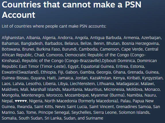
Good catch! Just a typo on my part. I used mapchart.com to make the map, and it was unfortunately an entirely manual process and the map builder I used didn’t include most microstates; the rest of the ones I listed weren’t on the map. Sri Lanka and Suriname are pictured though. :)

Sri Lanka and Suriname are pictured though?
Good catch! Just a typo on my part. I used mapchart.com to make the map, and it was unfortunately an entirely manual process and the map builder I used didn’t include most microstates; the rest of the ones I listed weren’t on the map. Sri Lanka and Suriname are pictured though. :)